Humanitarian demining results for October
December 9, 2025
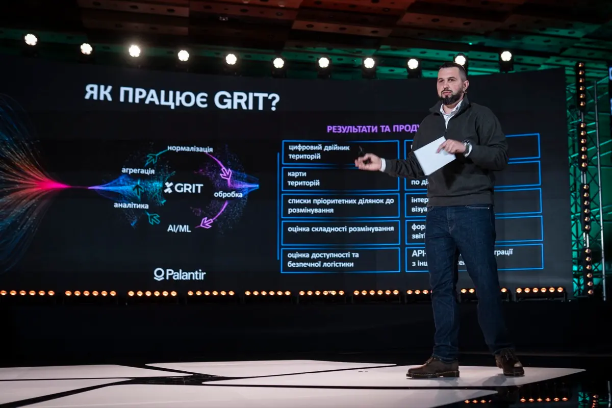
The digital platform for planning, prioritizing, and monitoring humanitarian demining, GRIT, was presented during the third Demine Ukraine Forum held on December 5 in Kyiv. Deputy Minister of Economy, Environment and Agriculture of Ukraine Ihor Bezkaravainyi explained what data the platform operates on, what tasks it can already perform, and how it will be integrated into mine action processes.
"Ukrainian experts and scientists in the fields of ecology, economics of social sciences, geographic information systems, and data engineering are working on the development of GRIT. Endowed with AI tools, a powerful infrastructure for building analytical models, and a good understanding of mathematics and logic, they can provide answers to a huge number of questions regarding the current state of territories and their future development. All necessary information is provided in convenient formats, allowing to compare areas and track dynamics," said Ihor Bezkaravainyi.
The GRIT platform creates a digital twin of each plot and uses analytical models to build well-founded decisions based on real and up-to-date data. During the presentation, Ihor Bezkaravainyi demonstrated an example of analytical scenarios: one polygon of likely contaminated territory with an area of about 6 hectares can block 137 cadastral plots with a total area of over 200 hectares. Owners do not cultivate their allotments because part of the plots may contain explosive remnants of war. Accordingly, the priority release of one polygon will make it possible to immediately return 200 hectares to work and restore economic activity on this land.
Another example of analytics the system is capable of doing is determining priority likely contaminated plots for clearance located within a 5-kilometer radius of schools where most students study offline. This is crucial for the safety of both teachers and children.
"For the government, the GRIT platform represents an opportunity to qualitatively shape national policies for demining and territory recovery based on the most current data. The platform can be useful to communities for the optimal development, reconstruction, and use of land after clearance. Businesses will find it interesting to get a digital profile of the plot on which they plan their activities, and mine action operators – soil and cover maps, and results of terrain satellite imagery analyses for effective work planning," noted Ihor Bezkaravainyi.
In the current demining process, GRIT is planned to be integrated at the stage of creating annual demining plans. The collected verified data make it possible to plan the clearance of precisely those territories where the effect will be greatest.
For reference: GRIT (Ground Rehabilitation through Innovation Technologies) is a digital platform for planning, prioritizing, and monitoring humanitarian demining, running on the platform of the tech giant Palantir. Currently, the platform uses more than 20 datasets from state and commercial registries, satellite data, operator data, etc., and plans to further expand its capabilities next year.