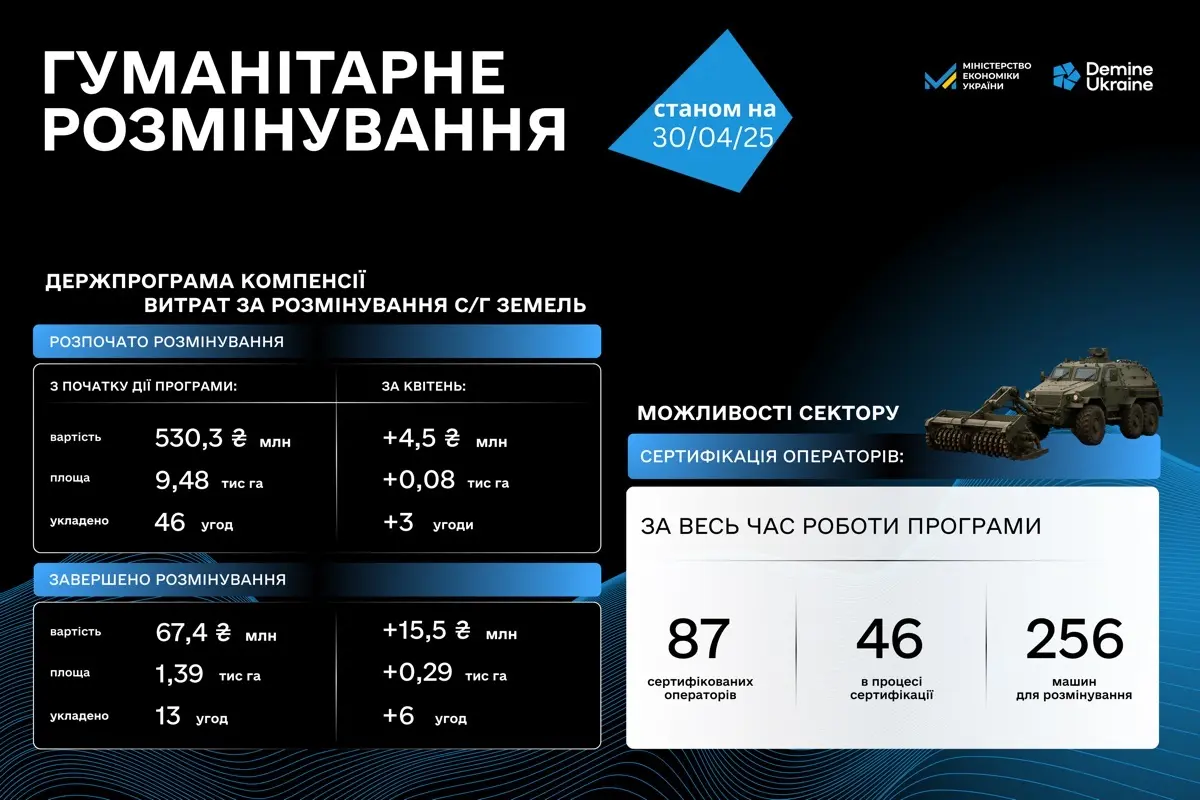
Humanitarian demining: results for March
May 5, 2025
More than 600,000 craters from shells and missiles: scientists have studied the de-occupied territories of Mykolaiv and Kherson regions. The study was conducted using satellite imagery and geospatial analysis methods and provided unique data on the scale of contamination.
"More than 600,000 craters — this is the visible trace of war on the land of southern Ukraine. Each crater is a potential source of contamination by explosive ordnance that was not detonated upon impact. This data helps us better understand the scale of the challenge and plan clearance more effectively," said Ihor Bezkaravainyi, Deputy Minister of Economy, Environment and Agriculture of Ukraine.
The study was conducted by a team of scientists using high-resolution satellite imagery. Researchers developed special algorithms for automatically identifying craters, which enabled the processing of large areas in a short time.
"This research has practical significance — it helps mine action planners understand where to concentrate resources. Areas with a high density of craters require more thorough survey and clearance," explained the lead researcher.
The data from the study will be integrated into the information systems used by the Centre for Humanitarian Demining and mine action operators for planning work. This will enable the use of a risk-based approach — directing resources to the most contaminated areas first.
"We are dealing with the largest mine contamination problem in the modern world. Scientific research helps us better understand its scale and develop more effective strategies for its resolution," noted the Deputy Minister.
The study is part of broader efforts to use remote sensing data and geospatial analysis in humanitarian demining. These technologies complement ground-based survey methods and allow for faster coverage of large areas.